Hike 26 – Forest Park – Wildwood Trail – Germantown to FL #15

Forest Park Wildwood

We had every intention of hiking Triple Falls today. After my post last week I got a few texts from SteveZ about his favorites and I was all set to head out there today and finally deposit Aunt Patti’s ashes somewhere worthy. There were a few snags in the plan. I went out with Lacey and Becky last night and had way too much fun, so I woke up late. My sister is sick with a cold that I am slowly spreading to every single person I know and eventually across the world, maybe universe (insert sinister laughter).  She took Theraflu (which she calls night time tea) and also slept in late, through her alarm even. Since the evil Costco scheduler has yet to stop ruining our Sundays, we had to be done by 2:30 again. Needless to say, we didn’t have time for Triple Falls, but we are totally looking forward to hiking it in the future. Thanks SteveZ!

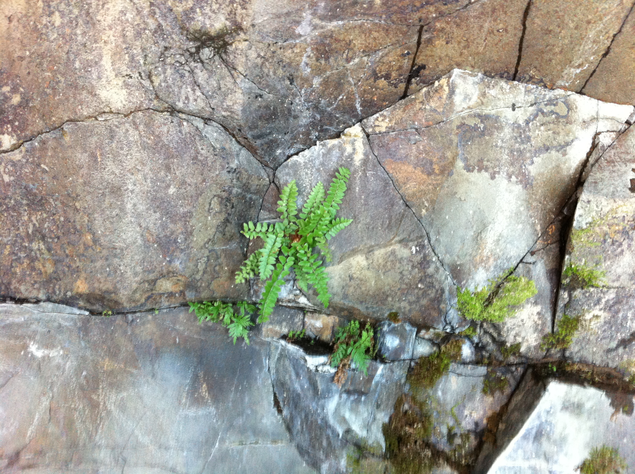
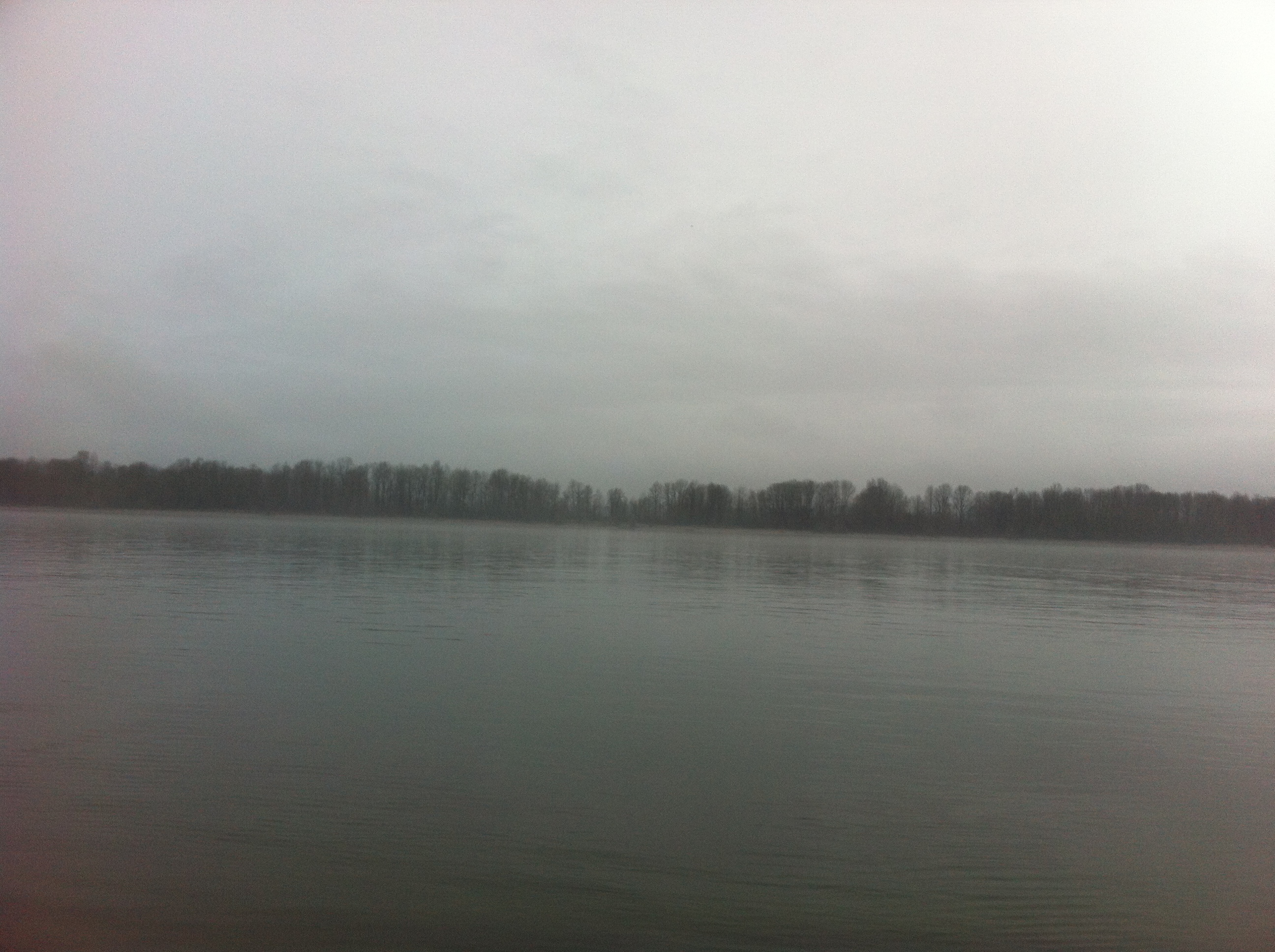
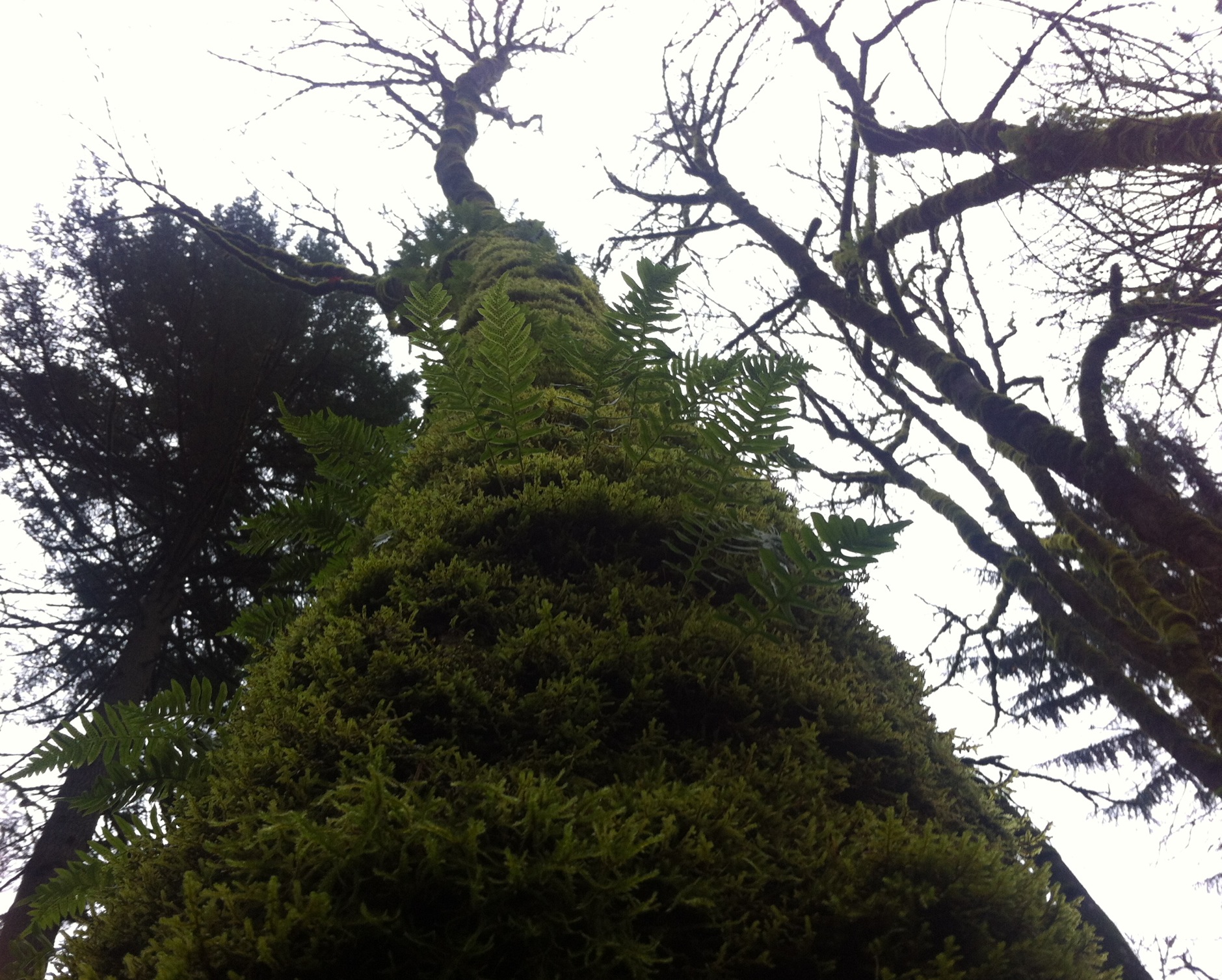
When I finally got to my sister’s house, I was pretty defeated. I had no idea where to hike today. She suggested Forest Park. We still have so many trails in Forest Park that we haven’t hiked yet. I know Wildwood alone is 30 miles, so we made it happen. We entered the trail on Germantown and hiked until we needed to head back to get my sister to work on time. After some highly advanced math (adding and subtracting) I have calculated that we did 7.5 miles out and back. The trail is truly beautiful and as it works its way through peaks and valleys the scenery changes dramatically. We saw a lot of runners. We were also almost killed by a horse-sized dog. It was truly frightening. When your dog is that big, leashes people!

It was pretty muddy on the trail considering the tiny amount of water we have received in the Pacific Northwest this year. I would have welcomed even more water and mud if it meant there was snow on the mountain. Come on snow. Come on.

As usual we talked of many things as we headed up and down and up and back down again meandering through the forest. We made a decision. We are both going to learn more about Tesla. He was just so cool. When we are done reading about him, we are going to build a Tesla coil. Why? Because we want to have a Tesla coil. Who doesn’t really? This was our train of thought:

1. I told my sister about Bill Murray and RZA and GZA walking into a bar and bar-tending one night. No matter what anyone ordered, they were served tequila shots. Hilarious, right?

2. Then we started talking about how Bill Murray and RZA and GZA must be friends because they were also together in the same segment of the movie Coffee and Cigarettes.

3. Then we started talking about Jack White wheeling around a Tesla Coil in a Radio Flyer wagon in the same movie.

4. Then we talked about Tesla for basically the rest of the hike.

Unlike Leif Erickson Drive, Wildwood Trail is actually a trail. If you’re going to hike in Forest Park, I recommend it. It’s my favorite in the park thus far. Despite the mud, it was pretty and an excellent day (there was even sun). Next week…something on majestic Mt. Hood. We are going to hike on Thursday because despite telling the scheduling lady time and time again that Sunday has been her day off for like a million years, my sister has to work next week again and this time all day. I’m starting to think that lady is ruining our fun intentionally. Knock it off, lady (I would normally call her something else, but I don’t want to offend anyone’s delicate sensibilities).

For information about Wildwood Trail click here.

Hike 25 – Salmon Creek Greenway

Salmon Creek

Who knew there were so many cool greenway paths in and around Portland? Probably someone, but not me. Each time my sister has to work on a Sunday (by the way terrible scheduling person at Costco, knock it off, she’s supposed to have Sundays off for Pete’s sake), we look for something close and not too challenging. There are a lot of good, long-ish, urban “hikes” that suit our purposes. We get to see interesting habitats and new neighborhoods. She has to work next weekend too, so I’m sure we won’t go anywhere amazing. We’ve actually been carrying around some of my aunt’s ashes to deposit somewhere beautiful, but we’ve yet to find the right place yet (except for when we forgot them in the car at Falls Creek Falls). I want to get back out in the wilderness soon. Cooperate weather. Cooperate evil Costco scheduler. Also, if you’ve ever done an amazing hike, I would welcome suggestions. I’m talking to you Josh Kanable, Jeremy Wedell, and SteveZ.

The Salmon Creek Greenway is in Vancouver, surprisingly along Salmon Creek (mind blown). We got a late start because my sister is house hunting and we had to be done so that she could get to work by 2:30. I ended up having to drive her to work because we got done too late. She also rushed into a Subway in Vancouver and got a sandwich while I waited to drive quickly away. No Subway for me. I had pizza.

The greenway starts in Salmon Creek Park which is super easy to find and get to. Then you follow the paved trail along a wetland. There is the rushing (in winter) creek and many ponds full of ducks and herons. We got within five feet of a giant heron and it didn’t move a muscle. I took a picture, but it didn’t turn out. The greenway was full of all sorts. There was one lady talking to herself both times that we passed her and I imagined she was reciting Hail Mary’s like in Don Jon (see it if you haven’t). My sister’s calf muscle has really been bothering her and even on this paved, flat trail it was hurting her. I hope that stops soon.

Clark County is working on restoring the salmon habitat in the creek so there are a ton of planting projects in the works along the trail. I like that. Bring nature back! The trail is 6.2 miles out and back and it has one tiny, maybe 10 foot, hill. We saw a foursome skateboarding the trail. That is the second pack of skateboarders we’ve seen in two weeks. I like it. The lone girl, who didn’t know what she was doing, was wearing a helmet. Hooray for not being too cool to save your brains!

I can’t remember what we talked about. I remember we laughed really hard. I also remember saying that I read the Failblog every day because every day it makes me laugh aloud. Everyone needs to laugh more. It’s good for you…and your abs!

It was a pretty trail. I recommend it. Pavement hurts me. I yearn for dirt and rocks and silence. Soon.

For information about the Salmon Creek Greenway Trail click here.

Hike 24 – Mosier Twin Tunnels

MosierFor whatever reason, I didn’t get around to writing this right away which is a darn shame because I can’t ever remember all the details when I wait longer than a couple hours. Oh well.

I do remember that my sister and I played Sid Hoffman or Sid Frenchman. It’s a heck of a game. If you’d like to see how it’s played you can watch this silly Strongbad email. You can even play the game if you click on “that game” at the end of the email.

As I’ve mentioned before, people often ask to join my sister and me on our hikes. We are totally open to people joining us. Lots of people have asked, but no one has ever actually come with us…until now. The one and only, wonderful and beautiful Lacey Wroblewski hiked with us today. I got to know Lacey because she is besties with one of my favorite people in the entire world: the magnificent, the glorious, the extraordinary “Doctor” Becky Curry. It was awesome to have a tag-a-long.

We met at my sister’s house, as usual, except we met at a set time instead of “whenever we wake up.” I was late, of course. This is a new thing for me. I have been on time to everything I’ve ever done basically my entire life until about three months ago. I’m not sure exactly what happened three months ago, but timeliness is no longer one of my priorities. Sorry world.

The ladies hopped in my car, we stopped at Subway (of course), and blasting the best of Bjork we headed east on 84. I didn’t really look at the exact mileage and the hike was quite a bit further away than most of the ones we have done recently. It was a bit of a drive. The trail head is basically in Hood River. You take the exit and drive just a little over a mile to the parking lot. We paid our fee and got to it.

It was so so so so cold. We did not expect it. Lacey, who is an amazing photographer, brought her fancy-pants camera along and took brilliant pictures. My sister and I mostly just died of cold. It was so cold. Because we were in the shade of the gorge, it basically never got warm. There was a layer of frost that coated the ground and all of the amazing desert plant life as we walked shivering in the shade. After a couple miles, the paved trail hits the trail’s main feature, the two tunnels. They are amazing, a mixture of rock and wood, nature and man. Lacey took incredible pictures of them.

After we made our way through the tunnels, which were much warmer due to lack of wind, we were starting to realize we would never be warm.  Just when we were giving up hope, we rounded a corner and there it was, a sunny patch! We got in really close to the rocks to avoid the wind and sat in the glorious sun scarfing our Subway in near silence. The warmth and food were so good. We were energized.

We kept heading east and finished the in part of the hike in no time. We were worried about the way back, heading back into the shade, but it wasn’t bad. It really wasn’t. There were a lot of people out on the trail. It was a great hike with great company.

For information about the Mosier Twin Tunnels Hike click here.

Hike 23 – Rock Creek Greenway

Rock Creek

I have to admit, it was hard to get a pretty picture today. Although there were plenty of pretty things to see, this particular hike is lined in its entirety by housing developments. There is nothing that says “nature” like the smell of laundry and breakfast. Seriously, yuck. Despite the proximity to houses, there were plenty of lovely things to see.

I picked the hike this morning right before we left. I’m starting to need more suggestions. Anyone? I need to get back to work so that my coworkers who all love to hike can tell me about more of their favorites. Plus, all of my best friends are at work. I love vacation, but I miss people.

I thought this would be a hard week. It wasn’t. Not at all. It was a pretty spectacular week in all honesty. Christmas can be hard on anyone. I’ve heard before that the holidays make lots of people depressed, highest suicide rates and such. That absolutely did not happen to me. I love seeing my family, watching people open presents, eating delicious food, and this year especially, meeting new people. It was a great week. I can’t wait until New Years at the Wroblewskis. It will be incredible.

The hike starts with soccer fields and a golf course, not our standard fair, but I knew that going in. The whole thing is paved so we have blisters. Pavement is not our friend. After the golf course, you enter into a wetland of sorts. There is a gorgeous lake with tons of ducks. We saw more birds today than on any other hike we have done. I’m really not a bird fan, but I appreciate the variety of birds we saw.

Once in the wetlands there are grasses, berries, cattails, and all sorts of other water-loving plants. It was really pretty. There were a ton of people on the trail. They were very friendly but apparently in Beaverton when you’re riding a bike it’s not trail etiquette to let people know you’re around until you almost murderize them. Only one person gave us a “on your left” before she went by. There was a near miss. The stupid lady didn’t say a word even after she tried to take my left arm on her bike ride with her. Get it together Beaverton.

Although the trail was lined with houses, it was still a great hike.  There was a lot to see, a “pastoral view” as it said on the Portland Field Hikers Guide, which is actually quite silly if you’ve ever seen a pasture. There are quite a few amazing parks that we walked through. We saw almost no children. I would say one of the reasons that someone would want to live in those houses is a place for their kids to play, but no one was. Why don’t kids play outside anymore? It makes me really sad. The total hike is 8.1 miles round trip with a little loop at the end. It has a little over 500 feet in elevation, but it didn’t feel like it.

For information about the Rock Creek Greenway click here.

Hike 22 – Warrior Point

Sauvie IslandA couple weeks ago, my friend, Lacey Wroblewski, mentioned a couple of hikes on Sauvie Island. I have never really spent any time on the island so I decided to check it out. My sister is working her wonky shifts in the bakery for Christmas, so she had to be at work by two. Last time she had to work at two, my 10.5 mile city hike nearly killed her. It took her three days to recover. I decided to do something simpler this time. There are two super short (just over two mile) hikes on Sauvie Island. There is also one that is seven miles but it has no elevation at all. I figured that was doable. I called my partner in crime and she said sure. We decided to hike to Warrior Point (the northenmost tip and coolio lighthouse on Sauvie Island).

It was easy to find. Basically every place on Sauvie Island is easy to find. We drove straight there and were ready to go by 10:30. With no elevation I figured 7 miles would take us a couple hours max and we’d be back in time for Subway and my sister’s dessert-making. We started off on the beach. It’s supposed to be a better view than the trail. The directions I got from the Portland Field Hiker’s Guide said to walk on the beach until it ended and then traipse through the woods to the trail. We tried that. The beach was wet but not unpleasant. Then we hit the trail. It was a muddy bog of epic proportions. I can’t even explain it. Basically there was no place to step in which you didn’t sink into 3-12 inches of boot swallowing mud. It was awful. We walked on the trail for about 20 minutes. We tried to stay to the sides but we kept getting cut up by thorns. We were both totally drenched in mud. It was stupid. The trail was completely destroyed. We headed back toward the beach.

There was a beach! We could walk there. Nope. We tried. We really did. It was sinky too. We had layers upon layers upon layers of mud and sand and leaves and seashells (rivershells?) on our boots. It was like walking on high-heels. Eventually we reached a place we could not negotiate. We decided to head back to the trail. I can’t even explain how determined I was to reach that stupid lighthouse. My sister kept saying, “Let’s just walk back down the beach past the trailhead.” I kept saying no. What I said actually contained a bit more profanity. However, I am a middle school teacher who’s students will eventually find this page so I will refrain from using expletives. Someone has to set an example, am I right?

I clambered up this fallen tree in an effort to get back to the trail. My sister just stood on the beach laughing at me. I eventually made it up, now drenched in mud from head to toe, and got stuck. I could see the trail but I could not reach it. It was still a muddy bog anyway. There was no point. There would be no trip to the lighthouse.

We headed back down the crazy sink-hole beach. It was a misadventure for sure. We walked passed where we had parked the car for awhile and then headed back. I would guess we walked somewhere between 3 and 4 miles total. It was not a very long distance, but we did a lot of acrobatics, boot-sinking missteps,  and crazy negotiating that I’m sure we worked muscles we didn’t even know we had. Someday I will see that lighthouse.

For information about the Warrior Point Hike here.

Hike 21 – Falls Creek Falls

falls creek falls

Last night I got to have a party with all of my favorite people in attendance. Even though I’ve technically lived in my house for six years, I’ve never had a party. Everybody brought delicious food. Josh Kanable made nachos. Robyn Simons made gluten free mini pizzas. Merriment was had. It was delightful. Unfortunately, it also made me dehydrated and achy and disorganized. We have absolutely no system for how we choose our hikes. Most of the time it just works out. This week, on Friday, Josh Kanable showed me a hike he really liked and I decided it would work. I didn’t really do much research or think it through.

We struggled a little bit to find the hike. It’s on the Washington side of the gorge across the Bridge of the Gods and then a little bit further east. The roads were icy and a little snowy and I definitely don’t have a snow-ready car. Sid handled like a dream and we made it to the right road finally and then we hit the road closed sign. The road to the trailhead is closed from December 1 to April 1.

We thought about it for a little bit. We turned around to head out and find something else. Then we parked and decided to just hike in. The Falls Creek Falls hike is a 6.2 mile loop with 1150 feet of elevation. However, when you have to hike 2.5 miles in and 2.5 miles back out, it’s an entire day adventure.

The road in was scary. It was covered with a layer of ice and snow. It was pretty dangerous. We tried to stick to the sides but it was really hard to negotiate. It felt like so much longer than 2.5 miles. We thought we would never ever reach the trailhead. Then we did. The hike was gorgeous. It stays mostly on the side of the rushing river. Today the river was ice-covered and amazing. There are neato bridges across the river. We joke around a lot about hike “features” and today beyond the bridges there were also ice traps and quick ice. Ice traps are ice underneath the dirt that you don’t know is there until you eat it. Quick ice is dirt that looks totally normal but it actually had ice underneath of it that has now melted and when you step on it you sink up to your ankles.

The trail was absolutely abandoned and amazing. When we finally reached the waterfall, all of the walking was worth it. Not only was it the prettiest waterfall we had ever seen, but it was frozen and there were amazing ice sculptures all around it. We took a ton of pictures and then headed back out. We then walked up to the upper trail and got to see the waterfall from the top plus an amazing extensive valley. It was worth the crazy uphill trek to get there.

On the way back down we ran into three women hiking. We were not alone! We hiked back on the other half of the loop and finally made it to the parking lot. It was definitely hard to finish but not be finished. The last 2.5 back to the car was hard but worth it. We got a great day of hiking in and we saw some truly beautiful terrain. Thanks for the recommendation, Josh!

For information about Falls Creek Falls click here.

Hike 20 – Forest Park to Pittock Mansion

pittockThe subtitle of this hiking blog is “a journey to find myself.” I haven’t spent a lot of time thus far talking about that. I was with my ex my entire adult life. You better believe that is a crazy adjustment. It still is. I really got to know my friend Lacey Wroblewski in Vegas. When I went to Vegas four months after the break up, I was a broken shell of a human being. When I saw Lacey recently, she told me how much I have changed, grown. And I have. It’s true. I have a lot of amazing people in my life. But these last two weeks have been really hard and I’m struggling. My aunt Patti died. It was unexpected and I loved her very much. I found out my best friends, who are mostly responsible for my ability to cope with this new single life, are moving away, and I had my first single Thanksgiving. There has been a lot of joy, but more tears. I’m really looking forward to the new year. I need a new year. Knowing that every Sunday my sister and I will wake up and hike keeps me grounded. Sometimes when it’s cold or raining people ask me, “Are you guys still hiking this weekend?” Yes. The answer will always be yes.

It was an uncharacteristically cold week in Portland. When we hit the trail on Sunday, it was in the 20s. We had to account for that so we stayed close to town. We hit Forest Park at the end of Upshur and took mostly the Wildwood Trail up to the Pittock Mansion. Funny story, I’ve actually spent quite a lot of time on this trail in the past. My friend Jeremy Charlson used to like to travel up to the Stone House (which we called Witch’s Castle) in the middle of the night. We liked to scare ourselves and fancy it haunted or some such nonsense. It was  good time. One time there were these amazing bio-luminescent bugs and we spent a long time watching them. In all the times I had hiked the trail in the past, I had never gone past the Stone House. It was really a great trail. It was a little bit tricky to negotiate due to ice hidden beneath the dirt. It was, however, the only time we have ever seen a park ranger on a hike. He was warning people about the ice. We stayed safe, but my sister did have a close call. The visible ice wasn’t a problem. It was the dust-covered hidden ice that was only revealed when someone slipped on it that gave us trouble.

Hiking is harder when it’s cold. I don’t know the actual science of it, but we struggled. It could have simply been the six layers of clothes that we were wearing or our topic of conversation which was mostly house-buying. The hike is only five miles total, but it felt longer. It has 900 feet of elevation. There are some pretty steep switchbacks and we were again surprised by the remoteness of the trail despite its location in the middle of the city. We saw a lot of people at the beginning and end of the trail where they could enter or exit quickly, but there were very few people in the middle. It was extremely cold out. People were very friendly though. So apparently, my theory about Forest Park making people nervous is a fail. It’s just Leif Erikson Drive. People are only jerks there. Weird.

Many of our hikes this year have featured beautiful views. Many of those views have been obstructed by crazy fog or other such weather. The view from Pittock Mansion did not disappoint. We could see all of downtown and majestic Mt. Hood in the distance. It was lovely. The two seconds it took me to take a picture were too long to have my mittens off though. Did I mention it was cold? Because I waited so long to write this, I can’t remember all of our conversations. That’s my favorite part. Darn. The variety of hikes available to us in or near Portland never ceases to amaze me. Twenty hikes down. Thirty-two to go!

For information about the Pittock Mansion hike click here.

Hike 19 – Marquam Trail to Council Crest

MarquamMy sister had to go to her nephew’s birthday party today so we had to do something close and relatively short. She had a busy day as we were also celebrating her birthday at dinner. She is old now, 32! I ran a couple of my normal searches for hikes and saw the Marquam Trail in southwest Portland. It was perfect. We hit the trail right off of Terwilliger Blvd and hiked through the Marquam Nature Park and southwest Portland neighborhoods (you cross several roads) up to Council Crest. The exact mileage is a bit iffy. Different sources say different things. It is about 6 miles out and back and has 1100 in elevation gain.

I never even knew the Marquam Nature Park existed. I was already amazed by the immensity of Forest Park within our city and now there is this too. I have lived in Portland my whole life and it never ceases to amaze me. The trail is not quite as up-hill-one-way-and-down-the-other as we are used to. It really has mixture of both, both ways. There is obviously a lot of uphill as you gain 1100 feet and end up at Council Crest (one of the best views in Portland) but it’s not all at once. One of the unique things about this trail is the number of houses you walk by. The trail meanders basically through people’s backyards. Some of the houses were crazy. It reminded me of the way the new tenants (The Deetzes) change the house in Beetlejuice. Creepy, modern angles and stick-me-outs, no me gusta.

Council Crest was socked-in. We couldn’t see a thing. It happens. It was a gloomy day in Portland. It was also very windy. After the hike I cleaned my gutters and put up my Christmas lights and I really thought I might die in the process. Wind and rain, welcome to December. We had a lot of time to talk on this hike. We were pretty much alone, so we continued the tale of the red mushrooms. If you read the blog faithfully, you may remember the red death drops and the red yums yums: indistinguishable from one another, one certain death, one ecstasy of flavor….anyway, today we decided that they are actually the same mushroom picked at different times. The red yum yum is picked earlier. It is truly delicious, the most delicious mushroom mother nature ever endeavored to create, but the red death drop is even better. It is so exquisite that if you partake you cannot be allowed to continue living. The mushroom matures to a state of ultimate perfection and then becomes so good it kills you. The last words of those who consume the fungus are often heard by loved ones. With his last breath a dying husband whispers in his wife’s ear, “Worth it.” Yep, that’s how we spend our time.

The Marquam trail is awesome. It’s absolutely covered in ferns, more ferns that I have ever seen anywhere else in my life (that’s for you, Jeremy Wedell).  Overall it’s a lot like Forest Park except for the trail is way more interesting. It curves and runs up and down and curves some more, then it crosses a bridge and takes you to some stairs. I guess I could have just said it has a lot of features. Anyway, I highly recommend it.

For information about Marquam Trail click here.

Hike 18 – Springwater Trail/Steel Bridge/Hawthorne Bridge

hawthIt’s Thanksgiving week! That means three things: I have an entire week off work, my sister will be turning 32 on Wednesday, and it’s pumpkin pie time at Costco. During the holidays Costco sells so many pumpkin pies that it requires the bakery to poach employees from other departments to keep up and get all the work done. My sister works in the bakery every day for the week before Thanksgiving and Christmas. She used to do a graveyard shift, but now it’s a swing. In other words, our hikes have to be done in time for her to make it to work by 2. That is certainly limiting.

When she couldn’t hike on Sunday (we went Thursday) a few weeks ago, I took a solo walk along the Springwater Corridor. We decided to do that walk again, but together. It’s totally flat and altogether just about 10.5 miles. We found out the hard way that walking on pavement is actually a lot harder on you that walking on dirt and rocks, even when it is flat. We both got blisters and other weird aches and pains.

The walk is lovely, especially on a cold, crisp, but sunny November day. The leaves are mostly down and the water is cold and clear. We started in Sellwood where Umatilla meets the Springwater Trail. We walked toward Oaks Park and the Oaks Bottom Wildlife Refuge and then continued on the trail toward Ross Island. The island, the river, the wildlife, it’s just lovely.  We continued walking past OMSI and onto the Vera Katz Esplanade and then crossed over the Steel Bridge. This weird duo ran past us as we were nearing the bridge. I think I noticed them because the older of the two was wearing a non-running friendly backpack with jingly keys in it. My sister and I decided they thought we were slow because we were wearing jeans and hiking boots, but we quickly caught up to them and then passed them. Then they ran around us again. My sister laughed. She said, “Three minutes and we’ll have to pass them again.” Sure enough, we passed them again on the west side shortly before we walked back across on the Hawthorne bridge. We may not have fancy workout clothes, but we don’t mess around. We are tall and we have long legs. We walk very very fast.

As we headed back toward Sellwood, we both started to get blisters and sore joints. The number of people who use the Springwater Corridor gives me a renewed faith in humanity though. Hundreds of people braved the cold to get out in the sunshine and get some exercise. I approve. I also got to see SteveZ as he rode by us in the opposite direction. It’s always nice to see a friendly face. Last time I walked the trail by myself I saw Eric Tsai. Apparently I can’t go for a walk in Portland without seeing someone familiar. Portland is beautiful, but I can’t wait to be back in the wilderness next Sunday!

For information about the Springwater Corridor click here.

Hike 17 – Two Chiefs Trail

Two ChiefsSince we hiked in the coast range last week and majestic Mt. Hood is covered in snow, my sister suggested a Columbia Gorge hike this week. After some searching we decided on the Two Chiefs Trail hike. It is on the Washington side of the Gorge, just the slightest bit west of the Bridge of the Gods. We found it with no problems, but the road to it was too much for our trusty steed (Sid Hoffman). Mazdas are pretty low to the ground and there were car-swallowing potholes. After we bottomed-out once, we decided to just park it and walk the extra amount. The official hike is 7.8 miles with 1250 feet in elevation gain, but we did a little bit more than that because of our parking spot.

The trail used to be a road, but it has been washed out over and over and over again and now is hard to negotiate even on foot. It immediately climbs 500 feet. It was too much for my sister. We stopped numerous times to shed layers of clothing and drink water. For the first time ever I was the person not holding up our hike.

There was a lot of water on this hike, a lot. The trail was washed out in numerous places and culverts that should have diverted the water under the trail were in disrepair or malfunctioning. We did not have waterproof shoes on but we both remained dry due to some crafty navigating. At one point we used a fungus covered stick we found to balance as we crossed a log that was trying to roll out from beneath us. It all worked out. My sister at first decided that the trail was called “Swampy Gillespie” instead of Two Chiefs Trail. Then after some unpleasant discussion we decided that having a swampy gillespie sounded like a euphemism for a horrible STD. She then started calling it “Crazy Creek Trail.” Seriously, in several sections the trail is a creek bed with running water. Our dry feet are a miracle.

After winding around and climbing through tons of different beautiful scenery, we finally reached a summit. The gorge view, the field of moss covered scree,  a gorgeous waterfall at Greenleaf Creek, and Table Mountain just above you make for a pretty epic end to your uphill journey. It was 2:30 when we hit the summit and it took us over two hours to get there. After the daylight savings change we were a little worried about getting caught in the dark. We have headlamps, so we’re not totally unprepared, but it was still a concern. On the way down, the parts of the trail with thick forest were very dark. Now that it’s November we will have to make sure to be careful about time. It took us just under four hours to complete the entire hike. The trail intersects with quiet a few others, so I’m sure we’ll be back in the area again. It was beautiful.

For information about Two Chiefs Trail click here.