Hike 5 – Southeast Portland Sunday Parkways

South EastWe had already done one Sunday Parkways route, why not another? Plus, this one reached to literally one block from my sister’s apartment. We had to do it. We both ate breakfast. We both had water. What could go wrong this time?

As we joined the progression, people recognized us. Most people at Sunday Parkways ride their bikes. Two girls walking the whole route, that stands out. It began to pour. We were soaked in minutes.  Yay, Portland! It was too hot to wear a coat and too cold not to. Since when is Portland so muggy? Whew.

Like the first route, this one wound through beautiful neighborhoods. We really like these walks because even though we are native Portland metro girls, we see streets we have never been on and sites we would never see otherwise. The difference between this route and the first was simple, Mt. Tabor. I hear bicyclists talk all the time about the triumph of climbing Tabor, but I’d actually never been up there not in a car. Walking up in the humidity made us hungry. My sister started to get “hangry.” I was worried about my survival.

We continued to weave through the neighborhoods and eventually made it back to her apartment. We then frantically googled the nearest Subway and devoured our lunch in utter silence. The Southeast route was 9 miles.

For information about Sunday Parkways click here.

Hike 4 – Timothy Lake

timothyAfter a summer of working, my sister and I both had a week off. We needed to get away. I think her head may have exploded if she had to work one more second. We decided on camping at Timothy Lake. Even though we grew up in Oregon City, neither of us had ever been there before (I know, crazy right?). We read about all the campsites on the interwebs and decided on The Cove. It was supposed to be sparsely populated because it is a hike-in site, less than half a mile. It sounded perfect.

We headed up Mt. Hood and down the long forestry road. I had vague, sketchy directions about where exactly The Cove was located. As I drove past a sign I was lucky to notice it was labeled “The Cove.” Needless to say, it was not what I expected. It was indeed a cove right on the water and quite fantastic, but it was on the road. Apparently the definition of hike-in is that you can’t drive your giant unnecessary truck on top of your picnic table. We had to haul our stuff about 100 feet. Whew. What a hike.

There is a hike around Timothy Lake. It is 13 miles. That is way further than anything we had ever done. It appeared to be relatively flat though, so it seemed doable. We knew we were going to do it. We just didn’t know when. It’s hard to take a break from all that sunbathing and lake swimming. We tried to convince our friends to come with us on a short jaunt to the dam. They didn’t want to. We said, “Fine we’ll go without you, brats.” My sister, her boyfriend, and I took off. We intended to walk about 15 minutes so we didn’t bring any food or water with us.

When we got to the dam, we had only been out for like 10 minutes. “Let’s keep going, ” someone said. Famous last words. We looked at the map and there was a perfect place for us to walk to and turn around just a little ways up, Meditation Point. We headed out. We hiked for awhile, on and on, and assumed since Meditation Point was so well-marked on the map that at some point we would hit it. The lake started to get slender and we quickly realized we were probably in the North Arm. The North Arm is the part of the hike that makes it so long. It’s an offshoot of the main lake. When we reached the campground our suspicions were confirmed. We checked the map again and North Arm was half of the hike. It made no sense to head back when we could just keep going and it was roughly the same distance. Again, we had no food or water.

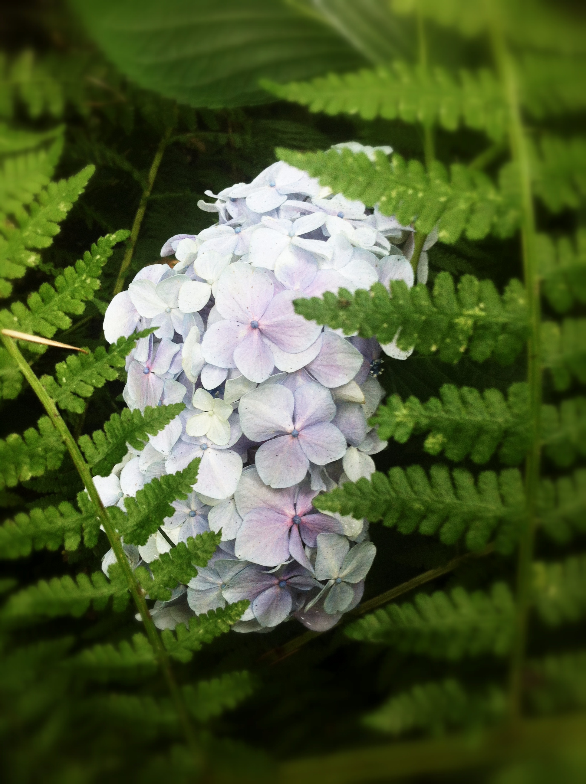
We continued on. I forgot to mention the beauty of Timothy Lake. There is no section of that hike that is not breathtaking: the color of the deep pools of water in the North Arm, the drapery of moss hanging from the trees, the variety of colorful mushrooms growing on every surface, and the crazy hillbillies who somehow drove into the middle of nowhere with a huge RV on no roads and were watching tv.

At some point the Timothy Lake Trail merges with the Pacific Crest Trail for awhile. We liked this. The trail was better tended after and had neat bridges and pathways. We talked about the craziness of the entire Pacific Crest Trail and that people actually hike the whole thing! Then, as we realized it was only an hour until dark and that our fingers were so swollen from dehydration that we couldn’t bend them, we missed a turn. We were supposed to go back to the Timothy Lake Trail and we stayed on the Pacific Crest Trail. I was in the lead. It was totally my fault.

We walked all the way out, away from the lake, to the forestry road we drove in on. We were a bit more than 3 miles away from our campground by road. We were racing the dark and battling our own bodies. It was survival instinct and muscle memory that got us back to camp. We walked 17 miles with no food or water. It was ridiculous. I will never forget it.

We all had our own recovery methods. Billy Pallotto saved my life by getting me orange juice when those were the only two words I could utter. Thanks Billy.

For information about Timothy Lake click here.

Hike 3 – Ecola State Park

 viewpoint

My sister did some research and picked this hike. Before we could even begin we had to drive all the way to Cannon Beach. Neither of us had been to the beach all summer. The Oregon coast is important to us. We had to get our feet wet before we began.

We drove into Cannon Beach and headed for the surf. We took off our shoes, enjoyed the sand and water, and reminisced about our beach-filled childhood. It was the perfect temperature for a hike.

We didn’t know where to eat. We drove by a Mexican place on the way into town. Why not? Because that is just stupid. We ate delicious food, way too much of it, and the first hour of the hike was excruciating. I would encourage you not to eat fatty food moments before you embark on rigorous physical activity. Yuck.

We found our way to the parking lot and headed for the trailhead. We didn’t really know where we were going but we intended to do about 7 miles. We headed north on a trail. It too was ‘moderate’ difficulty. Especially since we were cheese-filled, we were worried about the amount of down. That can only mean there is the same amount of up when you return. It was a great temp though and we were loving it.

The trail was well-maintained. There were steps here and there built into the beautiful scenery. We stopped at viewpoints and could see the crashing waves below. This trail’s plant life could not be more different than our previous hike. We appreciated the variety of scenery that Oregon provides. We have traveled a lot together and we don’t want to live anywhere else.

We walked through Indian Beach, part of the trail, and that’s when the real hike began. As we headed toward the hiker’s camp everything got much more difficult. We were going uphill, uphill, uphill with switchback after switchback after switchback. Even my sister was having to rest. We kept saying, “After this one we’ll be at the top.” That is now our hiking joke. It’s never after this one, never. When we reached the hiker’s camp, which is totally amazing and cool and I want to stay there, we decided we had gone far enough (only 6.1 miles).

There is a different trail back, a loop, and we took it. It was the craziest trail we had ever seen (super narrow and steep) and we were really glad we were going down it, especially when we passed the crying children who were coming up it.

There is nothing like the Oregon coast. I can’t wait to have more amazing trail adventures there.

For information about Ecola State Park click here.

Hike 2 – Ramona Falls

Hydrangea

I was looking for a good hike. My friend and co-worker Matt suggested Ramona Falls. I knew nothing about it. My sister and I are not strong hikers. We are weak actually. I googled the hike and it was rated ‘moderate.’ I had no idea what that meant but in retrospect I’m pretty sure it can be loosely translated as ‘straight up.’

Ramona is on majestic Mt. Hood (I only ever refer to Mt. Hood as ‘majestic Mt. Hood’). The trail intersects with the Pacific Crest Trail so there are all sorts of options. There is also a loop so you don’t have to entirely retrace your steps on the way back down. I recommend it. The hike is 7.1 miles. You start on one side of the river, twist and turn a bit in a mostly flat and totally breathtaking forest, then you cross a bridge. It is only in place during the summer. They remove it for high water. Once you cross to the other side the real hike begins. From then on it is basically uphill all the way to the beautiful and totally worth it falls.  I called it the ‘endless slight incline.’

Our hike was on a very very hot day. The majority of the hike is in the sun. We stopped a lot. My sister was actually okay, but there were times when I stopped nearly every 10 feet to catch my breath. When I get winded, particularly when I’m fat, I tend to hyperventilate. Despite all of the rests, we made it. The waterfall was even more incredible than I imagined. People mingled around it. There were lots of photographs.

There were black flies everywhere. They bothered us on the way up, but when we stopped at the falls for our Subway, it was unbearable. Upwards of 30 flies were on you at any given time. We couldn’t stand it. We ate fast and practically ran back down the trail.

This hike was amazing. We loved it and will definitely do it again. My sister fell in the parking lot before we even started and the outhouses at the beginning of the hike were the grossest I’ve ever seen in my entire life, but we’re going back. It was so beautiful. We both have little bites covering our bodies, war wounds from the flies; they make us infinitely cooler.

For information about Ramona Falls click here.