Hike 35 – Pacific Crest Trail from Bridge of the Gods

Dry Creek


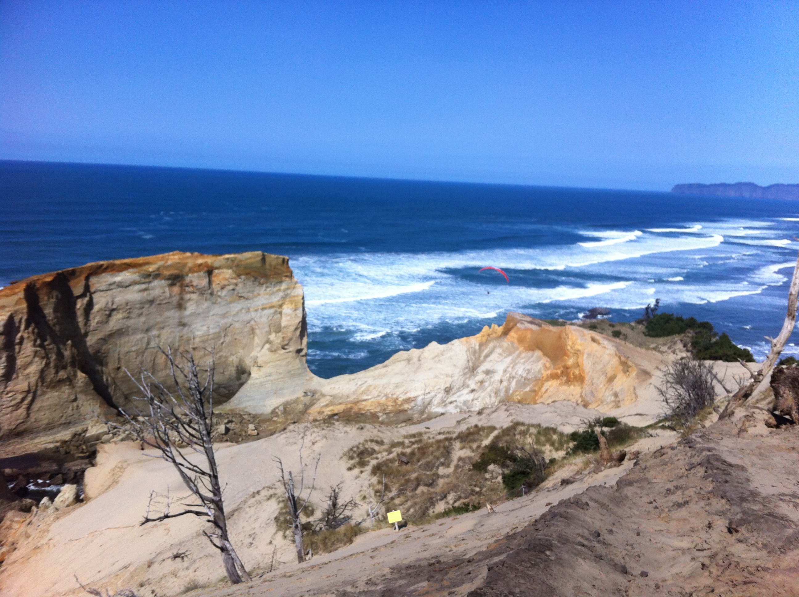
My sister has a set schedule again! Woot! She now has Thursdays and Fridays off. Boo. We’ll figure it out. We always do. Since it is Spring Break we decided to head out today, Thursday. I had an appointment in Gresham, so we decided to hike in the gorge. I couldn’t find what I was looking for when I ran my normal searches, so I just decided to hit the Pacific Crest Trail at the Bridge of the Gods and see where the day took us.

We found a parking spot right by the trail head and grabbed all of our waterproof gear. It was raining pretty darn hard. We had already stopped at Subway, so we were hoping to find a nice dry place somewhere to eat at our halfway point (where ever that ended up being).

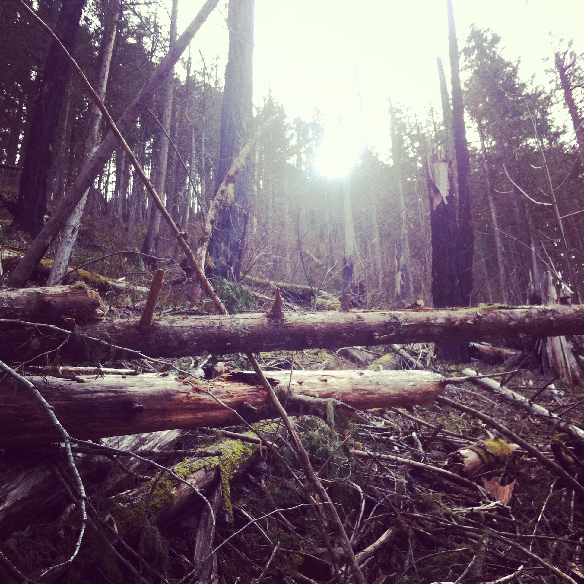
The trail is an “endless slight incline.” I’m going to trademark that phrase. My sister, as usual, hiked quickly and left me in the dust. When she sees a hill, regardless of how steep it is, she just puts her head down and trudges through. She starts walking really really fast and I cannot keep up. When she gets to a point where she can’t see me anymore, she stops and waits. It’s our tradition. It happened a lot today.

The Pacific Crest Trail is well marked. I appreciate that about it. There are so many trails that have no markings and you just have to guess and/or have really good notes. At every junction of the PCT, in the many places I’ve hit it during other hikes, there are great signs. Thank you whoever takes care of that! It’s awesome.

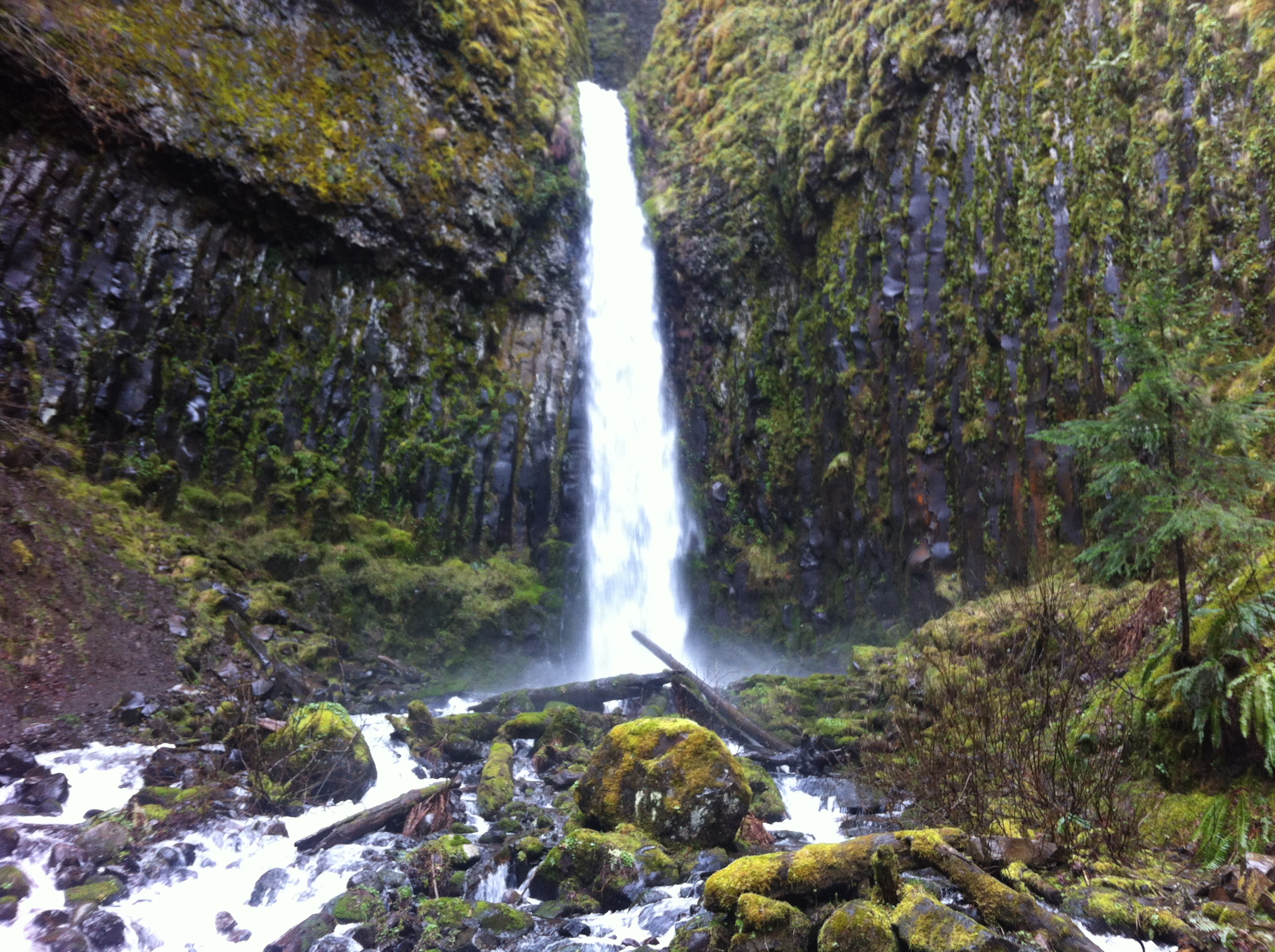
When we hit the junction that met up with Dry Creek Falls, we decided to take a short side trip to see it. There are never enough falls. They are lovely. There was also a nice bridge, feature, that my sister wanted desperately to cross for some reason. We did and we continued to hike up the trail. I would guess we did about 6 miles, but I can’t be sure. I also have no idea how much elevation, but we climbed for most of the hike. At some point, after a couple hours, my sister said, “I’m tired of going this way. Let’s eat and head back.” There was no where dry to eat so I sat on my hoodie in the middle of the trail. My sister ate standing up. There was little fanfare. We shared some water and headed back down.

Today’s conversation was mostly about credit debt so I’ll definitely spare you those details. We did spend some time talking about the trail itself though. My sister said it reminded her of the yellow brick road. The forest is untouched except for the trail. There are no offshoot trails, no other signs of life, just the trail. It’s almost like it doesn’t belong. I thought it was a good comparison.

There were some delightful children in front of us for about five minutes before their dad realized we were there. They were playing a rhyming game. It was cute. I thought my sister was going to play. She loves that kind of thing. A few times, the sun came out to visit us. At one point my sister said, “Look at this moss carpet. I wish I was a sprightly forest nymph so I could lay on that carpet and call the sun to me.” Yep, that’s her. I would love to, at some point, really hike the PCT. Hopefully I can make that happen.

For information about Dry Creek Falls click here.

For information about the Pacific Crest Trail click here.


Hike 34 – Sandlake-Cape Kiwanda

Beach

Spring Break in Oregon is generally a rainy affair. Starting tomorrow it will be, but we got four days straight of glorious, beautiful sunshine. You gotta take advantage. Besides Ecola on hike number 3, we haven’t done any beach hikes. There are a ton. We decided to go for distance so that we could spend the whole day in the sun and salt. I am actually quite sunburned this morning…and I love it. The Sandlake-Cape Kiwanda hike is 8.2 miles total. It is entirely on sand, most of it on the flat of the beach. There is 250 feet of elevation gain, but ALL of that elevation is climbing “The Great Dune” that separates Tierra Del Mar (the beach community where you park) from Pacific City. The dune is a heck of a workout.

We started out early. My sister got to my house at 8am. I made her cinnamon roll waffles. I saw it on the Failblog (under wins). You put four Pillsbury cinnamon rolls in your waffle iron and squish ’em down. Warning: they cook super fast, way faster than waffles. Then you have super fantastic cinnamon roll waffles and you put the frosting on them instead of syrup. I can’t have Pillsbury stuff, so I was really stoked to make them for her. She didn’t seem disappointed.

After breakfast we headed to Subway so we didn’t make the same mistake we made last time we went to the beach. Refer to the Ecola post. It involves far too much Mexican food and our inability to function. Then we headed out. Our grandparents retired to Bay City. My papa was even the mayor! Highway 6 is very familiar to us and it brought out a lot of memories. My mom used to sing to us on road trips. You better believe we sang a few of her songs.

Once we were through Tillamook we started talking about how beach towns are just a little bit “different” than other towns. Not Fantastic Mr. Fox different either, because that’s a good different. We were searching for an adjective when I hit on it and then it fit for the rest of the trip. The towns we passed through were just a little bit “methy.” Everything looks a little bit rundown, dirty, unkempt, drug-addled. You get the point. The beach is methy.

Once we hit Tierra Del Mar, our starting point, we immediately wanted to stay there. It’s delightful. We will definitely be back probably to rent a beach house. It’s sandwiched by Sandlake and Pacific City, but it’s a world of its own. It’s quite lovely. We found the parking lot easily and hit the beach. We immediately took off our shoes, of course, and headed north. We walked about three miles until we hit a river and couldn’t go any further then we turned back. We made up a whole story about how Sharock and our parents were staying in one of the houses on Tierra Del Mar and they had spaghetti and meatballs and beers waiting for us. It was a bit disappointing to camp out on a log and eat our Subway. A bit, but really we were on a beautiful beach so not really.

We continued heading south past our parking spot and toward The Great Dune. There were a ton of cars on the beach and people were paragliding off the dune, which by the way looks awesome. After a couple miles it was time to climb the dune. It took us a while and some climbing with our hands on the steepest parts, but we reached the top. Success!

After a about five minutes of taking in the amazing view and snapping a few model shots, we headed back down and back to the car. It was a nearly perfect day. I say nearly perfect because my sister got HUGE blisters on her feet. She was pretending to be a giant and smashing her “denizens” as we walked. We decided they had formed a rebellion and were poking her feet with pitchforks. How else does one get blisters when they are barefoot? Damn denizens. They can be so needy.

For information about the Sandlake-Cape Kiwanda hike click here.

Hike 33 – Clackamas River Trail

c riverWe actually got to hike on Sunday again. Thank you Costco scheduling lady! It only took my sister specifically requesting the day off a month ahead of time for that to happen. Totally legit….not. It was super rainy yesterday, but not while we were hiking. It was quite lovely actually. We had way too many layers on and ended up cramming our coats into our backpacks after about five minutes of actual hiking.

When my sister and I were young, our dad was a competitive whitewater rafter. He trained all year and he and my uncles competed in a rafting race/competition both as individuals and in group events. Because of these races and the self-imposed training schedule my dad followed, we spent a ridiculous amount of time on the upper portion (above the dams) of the Clackamas River out passed Estacada. I once saw my dad flip at Carter Falls and stay under for a long long time. It was absolutely terrifying. Obviously he eventually resurfaced and we went along with our lives.

Neither of us have ventured up the Clackamas in a really long time, so when JWed suggested the Clackamas River Trail as a hike, I was in. It was super easy to find and a quick drive. We scarfed our Subway in the car and headed across the street from the parking lot to the trail. It is a 7.8 mile trail along the river with 450 feet of elevation gain. We definitely didn’t have time for a 15+ mile hike with a late start, so we figured we’d hike for a few hours and then head back. As soon as we hit the trail our hopes were dashed. There was a sign explaining that the trail was washed out at the 2 mile mark and impassable. ‘Darn, we only get in 4 miles today,’ was my first thought. My second thought was, ‘We’ve seen lots of trails that are impassable and we’ve passed them just fine. We got this.’

In summary, we continued on the hike. It is a narrow trail that sticks to the river although it seemed like quite a bit more than 450 feet in elevation. We climbed and descended several times as we worked along the river. A fire had obviously raged through this portion of the forest and the wildlife was just starting to re-emerge. There were even signs of spring as buds bloomed on burned-out branches. The river was amazingly powerful. It was a deep shade of green with a treacherous current. It made us both want to go swimming. Water does that to us. Thanks, Dad.

Eventually we reached another sign that read “Turn around here.” We did not. There was also a little note in sharpie on the sign that read “Unless you are Nicole and Juday.” That made us hopeful. If those idiots could make it, so could we, right?

Just passed the sign we reached the first wash out. It looked passable. My sister didn’t even hesitate. She just walked right across it. What she didn’t see, but I did, is that every time she took a step the ground was literally crumbling beneath her, crumbling toward a shear rock face that lead about 200 feet down directly to the hypothermia river. Because I had seen the crumbling ground, I was terrified. I couldn’t do it. I was stuck. She came to get me and I eventually made it across, but I have never been scared on a hike before and I was scared.

We continued on and there was another wash out, even worse than the first. Someone had strung a rope across it to help you navigate, but that didn’t work for me. I have NO upper-body strength. If I was hanging from a rope, I would die. Period. We turned back. Now, I had to cross that stupid first wash-out all over again. Again, Jessie just did it. She went slower this time and was careful, but she was across….with rocks and earth tumbling beneath her. I actually cried a little bit when she was going. What the hell would I have done if she fell? I was in the middle of nowhere with no way to contact anyone. She would have died, for sure.  Then it was my turn. I was less scared for myself honestly. I gripped the mossy wall tightly and went slow. I made it. I will never do that again on a hike. So so so so so so stupid.

The way back was easy. We saw this totally weird guy hiking. We made up a whole story about him but here is the gist: Tweed jacket, dress shoes, dress pants, too-tight, belly bulging, yellow, tucked-in turltleneck, coffee mug, and bright orange army surplus vintage canteen. He was seriously weird. We decided he was trying to hard to be a hipster and a hiker and the hipster won the battle for the day. He was a laugh riot. I made up a voice for him but it won’t translate through this 😦

We got back to the car super fast and headed home. We did the 4 miles in about an hour and fifteen minutes. It was our shortest and most dangerous hike to date. I hope to do the whole thing some day.

For information about the Clackamas River Trail click here.

Hike 32 – Old Salmon River Trail

We had to hike on Monday. Next week, finally, we get to hike on Sunday again. I’m sooooo excited for that. It’s a wonderful thing to look forward to.

I left work right after the kiddos and met my sister and our tag-along, Sharock Bruce Hannah, right outside. They were hungry so we went to Subway first, even though I had dinner plans that night. It was delicious though and I only ate a tiny bit of dinner so it all worked out.

We drove up to Welches and hit the same trail we tried to do weeks ago when Josh Kanable led us astray 🙂 We started at the first trail head (because there are five) so that we could get in the maximum amount of hiking. The trail is old and worn and runs along-side the Salmon River. The river is roaring this time of year and quite beautiful. It’s five miles round trip and about 200 feet of elevation change total. It’s basically flat. There were a ton of bridges (features) of all different varieties. It was lovely.

The moss on the trees in this portion of the forest is insane. We often joke about the producers of Grimm “placing” moss on our walks. Apparently, people, who are not from Oregon, thought the moss in the trees on the show was “over the top” and “obviously fake” when the show first came out. We think that is hilarious, so we mention it often. We say, “Wow, the Grimm people did an excellent job on that one” or whatever.

There were a lot of places on the trail that were covered in water. We had to negotiate creeks running through the trail. Then we reached a place where the only way across was a log. I hopped up onto it and was across in no time. Then I started my long wait for Jessie and Sharock…..they never came. I had to go back and we went up to the road and went around it. Wimps.

After going around the creek we hit the trail again and were on our way. Since we had to rejoin the trail, we built a marker out of rocks and sticks so that we could find the right intersection on our way back. It worked like a dream.

My sister and Sharock washed out the jar that had Patti’s ashes in it in the river. They decided if it had any left it was wrong to throw it away. I agree. We took a stellar dual model pose this week, thanks Sharock. When we finished the hike we headed back to the car in almost darkness. Right as we reached the trail head a giant thunder clap rattled the world around us. It was time to go.

For information about the Old Salmon River Trail click here.